Changing Maps: How Peace Treaties Reshaped Europe and the Middle East
Inquiry Framework
Question Framework
Driving Question
The overarching question that guides the entire project.How did the peace treaties after the war change the world map and impact the way people lived, worked, and moved across Europe and the Middle East?Essential Questions
Supporting questions that break down major concepts.- How did the 'map of the world' change for a person living in Europe or the Middle East after the war?
- Why were so many families forced to move to new places or new countries when the war ended?
- How did the peace treaties change the way people earned money and traded with other countries?
- If you were a leader at the peace conference, how would you decide where to draw new borders?
- In what ways did the end of the war make life easier or harder for everyday citizens?
Standards & Learning Goals
Learning Goals
By the end of this project, students will be able to:- Identify and compare the geographic borders of Europe and the Middle East before and after World War I using map analysis.
- Explain the primary reasons for mass population movements and displacement resulting from the Treaty of Versailles and the collapse of empires.
- Describe the basic economic consequences of the peace treaties, including how trade and daily work were affected by new national boundaries.
- Analyze the human impact of border changes by evaluating how daily life became easier or harder for citizens in newly formed or dissolved nations.
- Demonstrate an understanding of 'cause and effect' by connecting specific treaty decisions to long-term political shifts in the Middle East and Europe.
Common Core State Standards (History/Social Studies)
World History Standards
Geography Standards
Entry Events
Events that will be used to introduce the project to studentsThe Classroom Border Crisis
Students arrive to find the classroom divided by physical tape lines that cut through desks and walkways, ignoring established 'student territories.' A 'Border Agent' issues new identity cards, informing students that their previous desks now belong to a different territory with different rules and languages.Portfolio Activities
Portfolio Activities
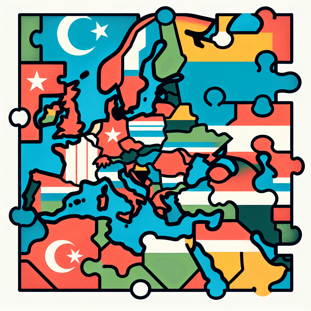
These activities progressively build towards your learning goals, with each submission contributing to the student's final portfolio.Map Morphers: The Disappearing Empires
In this introductory activity, students will act as 'Cartography Detectives' to identify the dramatic changes in the world map between 1914 and 1923. Using simplified, color-coded maps of Europe and the Middle East, students will pinpoint where empires fell and which new nations emerged. This visual foundation is crucial for understanding the scale of the peace treaties' impact.Steps
Here is some basic scaffolding to help students complete the activity.Final Product
What students will submit as the final product of the activityA 'Then and Now' Comparative Map Set with a list of five newly formed countries and the 'lost' empires they came from.Alignment
How this activity aligns with the learning objectives & standardsThis activity aligns with WH.10.6.1 by having students analyze the redistribution of territory and CCSS.ELA-LITERACY.RH.9-10.7 by integrating visual map data with historical analysis.Suitcase Stories: The Great Migration
Students will investigate the 'Why' behind mass migrations. Following the redrawing of borders, millions of people found themselves living in 'the wrong country.' Students will read simplified 'Person Profiles' (short biographies of fictional but historically accurate individuals) to understand the reasons for displacement and the challenges of moving across new international lines.Steps
Here is some basic scaffolding to help students complete the activity.Final Product
What students will submit as the final product of the activityA 'Suitcase Narrative'—a graphic organizer shaped like a suitcase that contains the reasons for a person's move and three challenges they faced.Alignment
How this activity aligns with the learning objectives & standardsAligns with WG.4.3 (Analyzing how political changes influence movement) and CCSS.ELA-LITERACY.RH.9-10.2 (Determining central ideas from secondary sources).The Border Tollbooth: Money and Markets
This activity focuses on the 'wallet' impact of the war. Students will look at how new borders split farms from markets and factories from raw materials. Using a simplified 'Trading Game' format, students will see how tariffs and new currencies made it harder for people to earn money and trade goods in the post-war economy.Steps
Here is some basic scaffolding to help students complete the activity.Final Product
What students will submit as the final product of the activityAn 'Economic Impact Poster' showing one 'Before' and 'After' scenario of a trade route or business affected by a new border.Alignment
How this activity aligns with the learning objectives & standardsAligns with WG.4.3 (Economic changes and location of human activities) and project learning goals regarding the economic consequences of peace treaties.Drawing the Lines: The Mandate Mystery
Focusing on the Middle East, students will examine the 'Mandate System.' They will look at how Britain and France divided territories like Syria, Iraq, and Palestine. Students will analyze a 'Mandate Map' and discuss whether the borders were drawn based on the people living there or the interests of the powerful nations.Steps
Here is some basic scaffolding to help students complete the activity.Final Product
What students will submit as the final product of the activityA 'Mandate Report Card' where students 'grade' the border decisions based on fairness and potential for future peace.Alignment
How this activity aligns with the learning objectives & standardsAligns with WH.10.6.1 (League of Nations' mandates) and CCSS.ELA-LITERACY.RH.9-10.7 (Quantitative/Technical analysis).The Ripple Effect: A World Remade
In this final summative activity, students will reflect on the entire project to answer the driving question. They will create a visual timeline or 'Ripple Effect' chart that connects a Treaty Decision (Cause) to a Border Change (Effect) and finally to a Human Impact (Result). This helps students see history as a series of connected events rather than isolated facts.Steps
Here is some basic scaffolding to help students complete the activity.Final Product
What students will submit as the final product of the activityThe 'World Remade' Portfolio Cover—a comprehensive visual chart summarizing the transformation of Europe and the Middle East.Alignment
How this activity aligns with the learning objectives & standardsAligns with all primary standards (WH.10.6.1, RH.9-10.7, RH.9-10.2, WG.4.3) by synthesizing geographic, economic, and human impacts.Rubric & Reflection
Portfolio Rubric
Grading criteria for assessing the overall project portfolioWorld Remade: Post-WWI Impact Portfolio Rubric
Geographic Transformation
Evaluates the student's ability to use visual map data to understand the redistribution of territory and political shifts.Map Analysis & Geographic Literacy
Ability to identify geographic changes between 1914 and 1923, including the collapse of empires and the creation of new nations/mandates.
Exemplary
4 PointsAccurately identifies all major lost empires and new nations; provides precise visual evidence on maps; offers a sophisticated explanation of the mandate divisions with clear supporting details.
Proficient
3 PointsCorrectly identifies the three lost empires and five new countries; labels mandate areas accurately; shows a clear understanding of the geographic shift from 1914 to 1923.
Developing
2 PointsIdentifies most empires and new nations but may have 1-2 errors; map work is partially complete; shows a basic but inconsistent understanding of how borders moved.
Beginning
1 PointsStruggles to identify empires or new nations; map work is incomplete or inaccurate; requires significant support to recognize geographic changes.
Human Impact and Displacement
Assesses the understanding of how political changes and new borders influenced the movement of people and their daily lives.Empathy & Migration Analysis
Ability to explain the reasons for population movement and the personal challenges faced by individuals relocated due to treaty-defined border changes.
Exemplary
4 PointsProvides a deeply empathetic and detailed suitcase narrative; clearly distinguishes between forced and voluntary movement with complex historical reasoning.
Proficient
3 PointsClearly explains why the person moved and identifies three logical items for their suitcase; summary accurately reflects the change in the person's sense of 'home.'
Developing
2 PointsIdentifies a reason for movement but lacks detail; suitcase items are listed but their importance is not fully explained; summary of 'home' is brief or vague.
Beginning
1 PointsFails to identify a valid reason for movement; suitcase items are illogical or missing; provides minimal reflection on the human impact of relocation.
Economic Consequences of Borders
Focuses on the student's ability to analyze the 'wallet' impact of the war and the resulting economic barriers.Economic Reasoning
Ability to connect new national borders to changes in trade, markets, and the cost of living for everyday citizens.
Exemplary
4 PointsCreates a sophisticated diagram showing complex trade interruptions; identifies multiple ways the economy was impacted; proposes an innovative business solution.
Proficient
3 PointsCorrectly diagrams a blocked trade path; lists two clear ways borders made goods more expensive; suggests a realistic solution for a business owner.
Developing
2 PointsDiagram of trade path is partially correct but lacks clarity; identifies only one economic impact; business solution is present but not fully explained.
Beginning
1 PointsFails to show how borders impact trade; cannot list economic consequences; business solution is missing or unrealistic.
Historical Synthesis (The Ripple Effect)
Evaluates the student's ability to answer the driving question by connecting treaty decisions to their long-term effects.Causality & Synthesis
Ability to synthesize geographic, economic, and human impacts into a cohesive 'Cause and Effect' argument regarding the peace treaties.
Exemplary
4 PointsSynthesizes all aspects of the project into a comprehensive 'Ripple Effect' chart; provides a profound concluding argument about the long-term impact of the treaties.
Proficient
3 PointsSuccessfully connects a treaty decision to a border change and a human result; provides a clear and logical concluding sentence based on evidence.
Developing
2 PointsAttempts to connect cause and effect but one link in the 'Ripple Effect' is weak or missing; concluding sentence is present but lacks supporting evidence.
Beginning
1 PointsFails to connect treaty decisions to real-world outcomes; 'Ripple Effect' chart is incomplete; concluding sentence is missing or irrelevant.