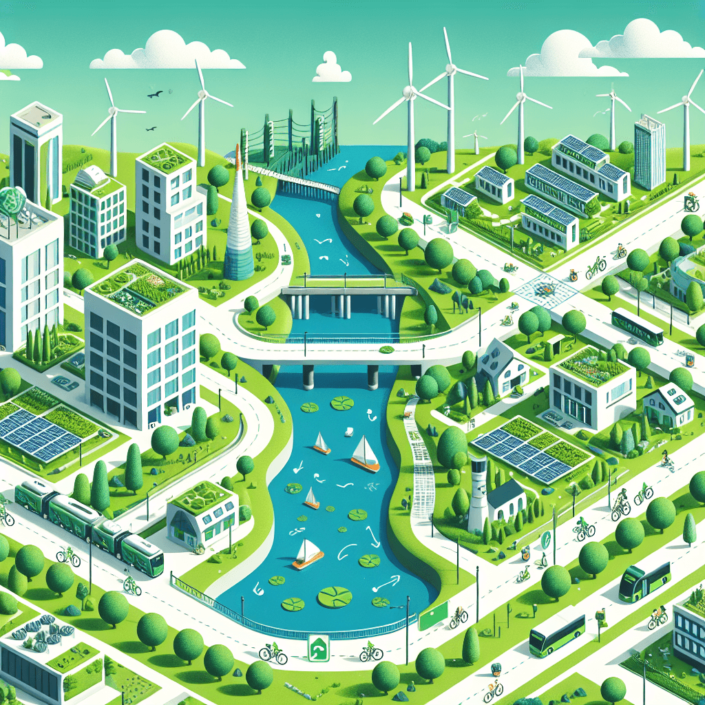
Eco-Friendly City Planning Challenge
Inquiry Framework
Question Framework
Driving Question
The overarching question that guides the entire project.How can we design an eco-friendly city that supports sustainable living, leverages local natural resources, accommodates diverse cultures, and efficiently moves people, products, and ideas?Essential Questions
Supporting questions that break down major concepts.- What is an eco-friendly city and why is it important for future generations?
- How do physical and political maps help us in designing a city?
- How do agriculture, industry, and natural resources influence the daily life of a community?
- In what ways can human modifications of the environment be positive or negative?
- How do transportation and communication systems affect the movement of people, products, and ideas?
- Why is cultural diversity important in a community?
Standards & Learning Goals
Learning Goals
By the end of this project, students will be able to:- Students will understand how to use physical and political maps to design city layouts.
- Students will explore the role of natural resources in sustainable city planning.
- Students will analyze human impacts on environments and propose eco-friendly alternatives.
- Students will investigate transportation and communication systems' role in urban planning.
- Students will appreciate the importance of cultural diversity in community planning.
State Geography Standards
State Social Studies Standards
Entry Events
Events that will be used to introduce the project to studentsVirtual Reality Tour of a Mega City
Start the project with an immersive virtual reality tour of a futuristic sustainable mega city. Students will experience eco-friendly technologies firsthand, including vertical gardens, renewable energy sources, and green public transportation systems, sparking their imagination and curiosity about creating their own city.Portfolio Activities
Portfolio Activities
These activities progressively build towards your learning goals, with each submission contributing to the student's final portfolio.Map Mastery & City Layout Workshop
The students will learn how to read and use physical and political maps to design eco-friendly city layouts. They'll identify locations for green public spaces, residential and industrial areas, and transport networks using alphanumeric grids and cardinal directions.Steps
Here is some basic scaffolding to help students complete the activity.Final Product
What students will submit as the final product of the activityA city layout map featuring clearly marked zones for different purposes using the map's elements.Alignment
How this activity aligns with the learning objectives & standardsAligns with Geo.3.1 by teaching students to utilize maps for effective city design.Resource Investigators: The Green Quest
Students explore the role of natural resources in sustainable city planning. They'll research local natural resources and consider how to incorporate these into their city plans to promote sustainability, such as using solar panels or local crops.Steps
Here is some basic scaffolding to help students complete the activity.Final Product
What students will submit as the final product of the activityA report detailing the chosen natural resources and a schematic showing how these will be implemented.Alignment
How this activity aligns with the learning objectives & standardsAligns with Soc.Stud.3.2 by analyzing the role of natural resources in city planning.Eco-Impact Analysis & Design Challenge
In this activity, students will identify and analyze the impact of human modifications on the environment, both positive and negative. They'll then propose at least one eco-friendly modification that could be applied to their city using this knowledge.Steps
Here is some basic scaffolding to help students complete the activity.Final Product
What students will submit as the final product of the activityA presentation detailing observed modifications and proposed eco-friendly alternatives.Alignment
How this activity aligns with the learning objectives & standardsAligns with Geo.3.3 to emphasize analyzing modifications and proposing sustainable alternatives.Transport Engineers: Moving In Harmony
Students will plan efficient transportation and communication systems for their eco-friendly city. They'll focus on sustainable options such as electric buses, bicycle lanes, and digital communication hubs.Steps
Here is some basic scaffolding to help students complete the activity.Final Product
What students will submit as the final product of the activityA detailed plan showcasing a city’s transportation and communication network, highlighting its sustainability features.Alignment
How this activity aligns with the learning objectives & standardsAligns with Geo.3.4, exploring the movement of people and ideas in urban planning.Cultural Mosaic Builders
Students delve into the cultural aspects of their eco-friendly city, exploring the value of cultural diversity. They’ll identify cultural groups and plan city features that celebrate diversity, such as community centers, festivals, and cultural exchange programs.Steps
Here is some basic scaffolding to help students complete the activity.Final Product
What students will submit as the final product of the activityA cityscape model or illustration detailing cultural features that embrace diversity.Alignment
How this activity aligns with the learning objectives & standardsAligns with Soc.Cul.3.1 by promoting the understanding and inclusion of diverse cultural groups.Rubric & Reflection
Portfolio Rubric
Grading criteria for assessing the overall project portfolioEco-Friendly City Planning Evaluation Rubric
Map Utilization and City Layout
Assesses students' abilities to use physical and political maps to design effective and eco-friendly city layouts.Map Component Identification
Evaluates the ability to identify and use components of physical and political maps such as the title, key, grid, and cardinal directions.
Exemplary
4 PointsIdentifies all map components accurately and effectively uses them in city planning.
Proficient
3 PointsIdentifies most map components correctly and uses them appropriately in city planning.
Developing
2 PointsIdentifies some map components but uses them inconsistently in city planning.
Beginning
1 PointsStruggles to identify map components and has difficulty using them in planning.
City Layout Design
Evaluates the design of the city layout, focusing on clear zoning and eco-friendly features.
Exemplary
4 PointsCreates a well-organized city layout with innovative eco-friendly features that are clearly marked.
Proficient
3 PointsDesigns a cohesive city layout with clear zoning and several eco-friendly features.
Developing
2 PointsDesigns a city layout with basic zones and few eco-friendly features that lack clarity.
Beginning
1 PointsProduces a disorganized or incomplete city layout with minimal eco-friendly features.
Natural Resource Integration
Assesses understanding and application of natural resources in promoting sustainability in city planning.Research and Resource Identification
Evaluates the ability to research and identify natural resources relevant to sustainable living.
Exemplary
4 PointsThoroughly researches and identifies diverse natural resources, with innovative ideas for sustainable integration.
Proficient
3 PointsResearches and identifies relevant natural resources with ideas for sustainable integration.
Developing
2 PointsIdentifies some natural resources but provides limited ideas for integration.
Beginning
1 PointsStruggles to identify natural resources and offers minimal ideas for use.
Schematic Application
Evaluates the plan to apply researched natural resources into the city model effectively.
Exemplary
4 PointsDevelops a detailed and innovative plan for applying natural resources, enhancing sustainability significantly.
Proficient
3 PointsPresents a coherent plan for natural resource application that supports sustainability.
Developing
2 PointsSuggests a basic plan with some application of natural resources for sustainability.
Beginning
1 PointsDevelops an incomplete plan with minimal resource application for sustainability.
Human Environment Interaction and Modifications
Evaluates students’ analysis of human impacts on environments and their ability to propose sustainable solutions.Impact Analysis
Assesses the ability to analyze both positive and negative human modifications on the environment.
Exemplary
4 PointsProvides an insightful analysis of multiple human modifications with comprehensive descriptions of their impacts.
Proficient
3 PointsAnalyzes human modifications and describes their impacts with clarity.
Developing
2 PointsOffers a basic analysis of human modifications with limited descriptions of impacts.
Beginning
1 PointsStruggles to analyze human modifications and their impacts effectively.
Proposing Solutions
Evaluates the ability to propose eco-friendly alternatives to observed negative modifications.
Exemplary
4 PointsSuggests innovative and practical eco-friendly alternatives with a focus on sustainability.
Proficient
3 PointsProposes viable eco-friendly alternatives to negative modifications.
Developing
2 PointsProposes basic eco-friendly alternatives but with limited practicality.
Beginning
1 PointsStruggles to suggest viable eco-friendly alternatives, providing minimal solutions.
Transportation and Communication Systems Planning
Assesses planning of sustainable transportation and communication networks for the city model.System Design and Integration
Evaluates the design and integration of sustainable transportation and communication systems.
Exemplary
4 PointsDesigns an innovative and well-integrated system featuring advanced sustainable options.
Proficient
3 PointsCreates a cohesive system plan with sustainable transportation and communication elements.
Developing
2 PointsDesigns a basic system with some sustainable elements, but lacks full integration.
Beginning
1 PointsStruggles to design a cohesive system with minimal sustainable elements.
Cultural Diversity and Community Planning
Assesses incorporation and understanding of cultural diversity within the city model design.Cultural Feature Inclusion
Evaluates the inclusion and design of cultural features that celebrate diversity in the city.
Exemplary
4 PointsIncorporates a rich diversity of cultural features, showcasing extensive understanding and inclusion.
Proficient
3 PointsIncludes a range of cultural features, effectively highlighting diversity.
Developing
2 PointsIncludes basic cultural features but with limited diversity representation.
Beginning
1 PointsStruggles to include cultural features and diversity in the design.