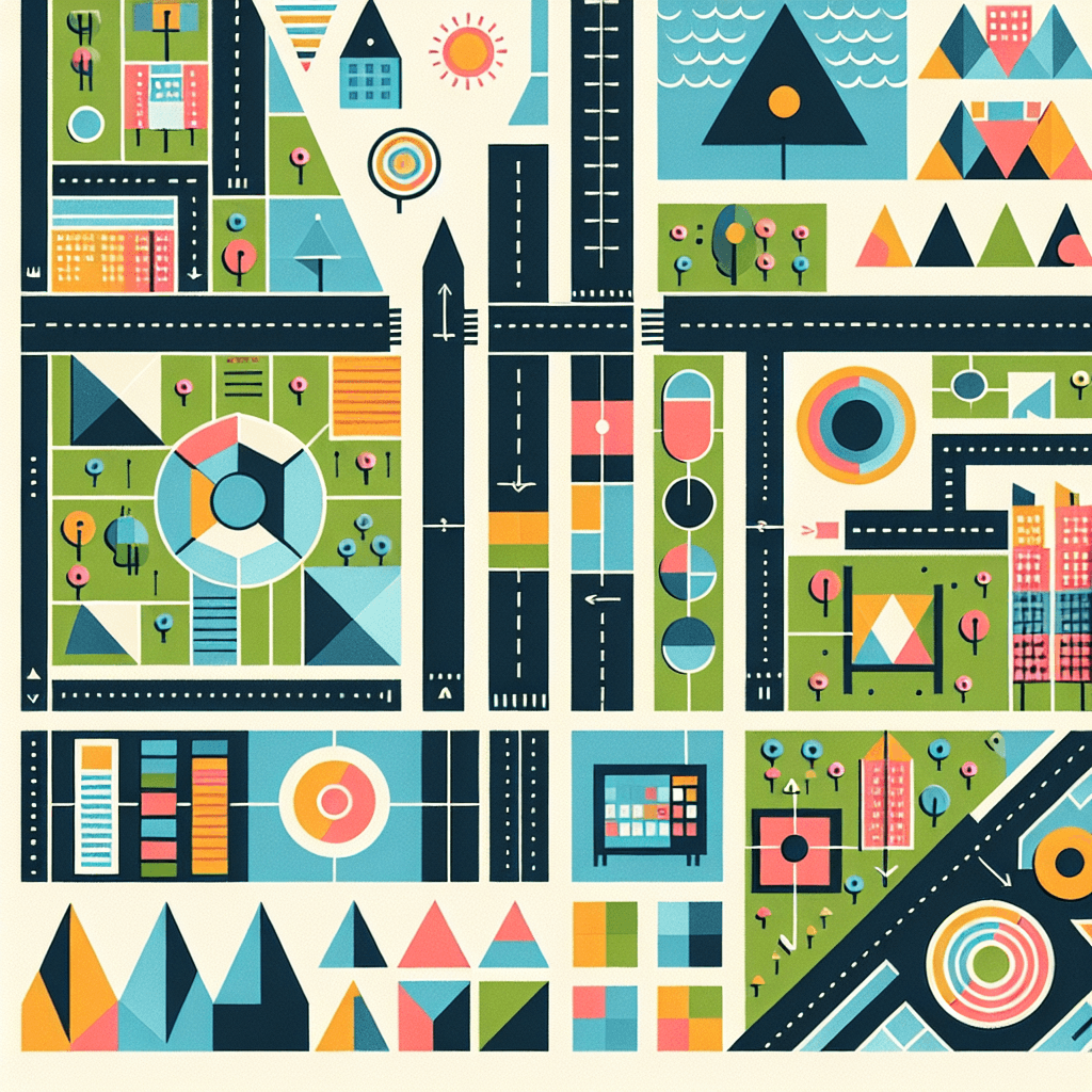
Geometric City Planning
Inquiry Framework
Question Framework
Driving Question
The overarching question that guides the entire project.How can we design a functional and sustainable city layout that optimizes space and resources using geometric transformations and principles?Essential Questions
Supporting questions that break down major concepts.- How can geometric transformations be used to optimize space?
- What geometric shapes are most efficient for different urban functions?
- How do transformations affect the properties of geometric figures?
- How can coordinates be used to represent locations and transformations in the city plan?
- How can technology be used to aid in the design and visualization of the city plan?
Standards & Learning Goals
Learning Goals
By the end of this project, students will be able to:- Apply geometric transformations (translations, rotations, reflections, dilations) to design city layouts.
- Calculate and optimize area and perimeter of city blocks using geometric principles.
- Use coordinates to represent locations and transformations in the city plan.
- Incorporate various geometric shapes for different urban functions (residential, commercial, recreational).
- Utilize technology for design and visualization of the city plan.
Common Core Standards
Entry Events
Events that will be used to introduce the project to studentsUrban Expansion Challenge
The local city council announces a rapid population increase and needs student teams to propose geometrically optimized expansion plans using only transformations. The team that designs the most efficient and aesthetically pleasing expansion, while adhering to a strict budget, wins.Portfolio Activities
Portfolio Activities
These activities progressively build towards your learning goals, with each submission contributing to the student's final portfolio.Geometric Vocabulary Builder
Students will define key geometric terms and illustrate them, building a foundation for applying these concepts in city planning.Steps
Here is some basic scaffolding to help students complete the activity.Final Product
What students will submit as the final product of the activityA glossary of geometric terms with definitions, illustrations, and relevance statements.Alignment
How this activity aligns with the learning objectives & standardsHSG-CO.A.1 (Know precise definitions of geometric terms)Transformation Station
Students explore geometric transformations (translations, rotations, reflections, dilations) using geometry software and physical manipulatives to understand how these transformations affect geometric figures.Steps
Here is some basic scaffolding to help students complete the activity.Final Product
What students will submit as the final product of the activityA presentation or report detailing each transformation, its effect on coordinates, and whether it preserves distance and angle.Alignment
How this activity aligns with the learning objectives & standardsHSG-CO.A.2 (Represent transformations and compare their properties)City Planner
Students integrate individual city blocks into a cohesive city layout, using coordinates to map locations and transformations, ensuring efficient use of space and resources.Steps
Here is some basic scaffolding to help students complete the activity.Final Product
What students will submit as the final product of the activityA comprehensive city plan, including a coordinate map, descriptions of transformations, and a rationale for the overall design in terms of efficiency and sustainability.Alignment
How this activity aligns with the learning objectives & standardsHSG-CO.A.1 (Applying definitions to design) and HSG-CO.A.2 (Applying transformations to optimize space)Rubric & Reflection
Portfolio Rubric
Grading criteria for assessing the overall project portfolioGeometric City Planning Portfolio Rubric
Geometric Vocabulary
Understanding and accurate application of geometric definitions (point, line, angle, circle, perpendicular line, parallel line, line segment).Accuracy of Definitions
Correctness and completeness of geometric definitions.
Exemplary
4 PointsProvides precise and comprehensive definitions for all geometric terms, demonstrating a deep understanding of fundamental concepts.
Proficient
3 PointsProvides accurate definitions for most geometric terms, with only minor inaccuracies or omissions.
Developing
2 PointsProvides basic definitions for some geometric terms, but with significant inaccuracies, omissions, or misunderstandings.
Beginning
1 PointsStruggles to define geometric terms accurately, demonstrating limited understanding of fundamental concepts.
Clarity of Illustrations
Quality and accuracy of visual representations of geometric terms.
Exemplary
4 PointsCreates clear, accurate, and detailed illustrations for all geometric terms, enhancing understanding and application.
Proficient
3 PointsCreates accurate illustrations for most geometric terms, with adequate clarity and detail.
Developing
2 PointsCreates illustrations for some geometric terms, but with limited accuracy, clarity, or detail.
Beginning
1 PointsStruggles to create accurate or clear illustrations for geometric terms, hindering understanding.
Relevance to City Design
Explanation of how each geometric term is relevant to city planning and design.
Exemplary
4 PointsProvides insightful and comprehensive explanations of how each geometric term is directly relevant to practical applications in city design, showcasing a strong connection between theory and practice.
Proficient
3 PointsProvides clear explanations of how most geometric terms are relevant to city design, demonstrating a good understanding of their practical applications.
Developing
2 PointsProvides basic explanations of how some geometric terms are relevant to city design, but with limited detail or connection to practical applications.
Beginning
1 PointsStruggles to explain the relevance of geometric terms to city design, demonstrating a weak connection between theory and practice.
Geometric Transformations
Application and understanding of geometric transformations (translations, rotations, reflections, dilations) and their properties.Accuracy of Transformations
Correctness and precision in performing geometric transformations using software or manipulatives.
Exemplary
4 PointsPerforms all geometric transformations accurately and precisely, demonstrating a sophisticated understanding of their effects on geometric figures.
Proficient
3 PointsPerforms most geometric transformations accurately, with only minor errors or inconsistencies.
Developing
2 PointsPerforms some geometric transformations accurately, but with significant errors or inconsistencies.
Beginning
1 PointsStruggles to perform geometric transformations accurately, demonstrating limited understanding of their effects.
Coordinate Representation
Accurate representation of transformations using coordinates and function descriptions.
Exemplary
4 PointsAccurately represents all transformations using coordinates and clear function descriptions, demonstrating a deep understanding of their mathematical representation.
Proficient
3 PointsAccurately represents most transformations using coordinates and function descriptions, with only minor errors or omissions.
Developing
2 PointsRepresents some transformations using coordinates, but with significant errors, omissions, or unclear function descriptions.
Beginning
1 PointsStruggles to represent transformations using coordinates, demonstrating limited understanding of their mathematical representation.
Property Comparison
Comparison of transformations that preserve distance and angle to those that do not.
Exemplary
4 PointsProvides a comprehensive and insightful comparison of transformations that preserve distance and angle to those that do not, explaining the underlying mathematical principles.
Proficient
3 PointsProvides a clear comparison of transformations that preserve distance and angle to those that do not, demonstrating a good understanding of their properties.
Developing
2 PointsProvides a basic comparison of transformations that preserve distance and angle to those that do not, but with limited detail or explanation.
Beginning
1 PointsStruggles to compare transformations that preserve distance and angle to those that do not, demonstrating a weak understanding of their properties.
City Design and Optimization
Integration of geometric principles and transformations in the design of a functional and sustainable city layout.Cohesiveness of Design
Integration of individual city blocks into a cohesive and well-organized city layout.
Exemplary
4 PointsCreates a highly cohesive and well-organized city layout, demonstrating a sophisticated understanding of urban planning principles and geometric relationships.
Proficient
3 PointsCreates a cohesive and well-organized city layout, demonstrating a good understanding of urban planning principles.
Developing
2 PointsCreates a city layout with some degree of cohesiveness, but with noticeable organizational issues or inconsistencies.
Beginning
1 PointsStruggles to create a cohesive or well-organized city layout, demonstrating limited understanding of urban planning principles.
Coordinate Mapping
Accurate and effective use of a coordinate system to map locations and transformations.
Exemplary
4 PointsUses a coordinate system to accurately and effectively map the locations of all key features and transformations, providing a clear and comprehensive representation of the city plan.
Proficient
3 PointsUses a coordinate system to accurately map the locations of most key features and transformations, with only minor errors or omissions.
Developing
2 PointsUses a coordinate system to map the locations of some key features, but with significant errors, omissions, or inconsistencies.
Beginning
1 PointsStruggles to use a coordinate system to map the locations of key features, demonstrating limited understanding of coordinate geometry.
Rationale and Sustainability
Justification of the city design in terms of efficiency, sustainability, and geometric principles.
Exemplary
4 PointsProvides a compelling and well-supported rationale for the city design, demonstrating a deep understanding of efficiency, sustainability, and the application of geometric principles.
Proficient
3 PointsProvides a clear rationale for the city design, demonstrating a good understanding of efficiency, sustainability, and the application of geometric principles.
Developing
2 PointsProvides a basic rationale for the city design, but with limited detail or connection to efficiency, sustainability, or geometric principles.
Beginning
1 PointsStruggles to provide a rationale for the city design, demonstrating a weak understanding of efficiency, sustainability, and geometric principles.