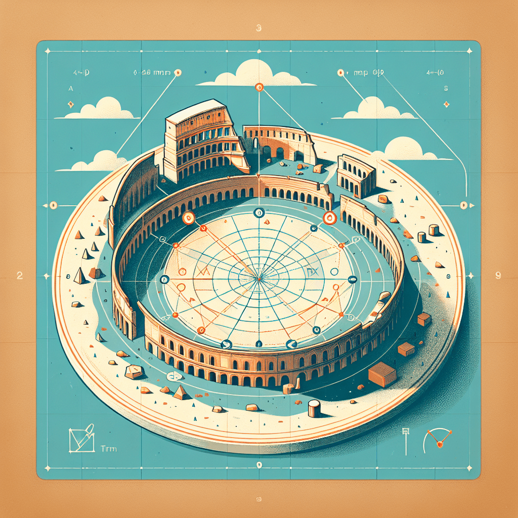
The Lost Arena: Mapping Circular Ruins with Geometry
Inquiry Framework
Question Framework
Driving Question
The overarching question that guides the entire project.How can we, as mathematical archaeologists, use circle equations and the distance formula to reconstruct and prove the original design of a lost ancient arena from fragmented GPS coordinates?Essential Questions
Supporting questions that break down major concepts.- How can coordinate geometry be used to reconstruct an ancient structure from only a few pieces of spatial data?
- What is the relationship between the center and radius of a circle, and how does this define its equation on a coordinate plane?
- How can the distance formula serve as a tool for proving whether a set of discovered points belongs to a specific circular boundary?
- Why is the ability to translate physical locations into mathematical equations vital for modern fields like archaeology, GPS technology, and architecture?
- How does changing the location of a circle’s center or the length of its radius impact its representation on a map?
Standards & Learning Goals
Learning Goals
By the end of this project, students will be able to:- Derive and apply the center-radius form of the equation of a circle (x - h)² + (y - k)² = r² to represent the boundary of the ancient arena on a coordinate plane.
- Utilize the distance formula to verify whether specific GPS coordinates (spatial data points) lie on the circumference of the circle, thereby proving the site's original dimensions.
- Analyze fragmented coordinate data to solve for the unknown center (h, k) and radius (r) of a circular structure.
- Construct a scaled mathematical model or map of the 'Lost Arena' that demonstrates the translation of physical spatial data into algebraic representations.
- Evaluate the role of coordinate geometry in professional fields like archaeology and GPS technology through a final project presentation.
Common Core State Standards (Mathematics)
Teacher-Defined Standards
Entry Events
Events that will be used to introduce the project to studentsThe Corrupted Signal: Mission Critical Reconstruction
Students receive a 'classified' video transmission from an archeological site where the lead researcher explains that their GPS mapping software has crashed, leaving only a scattered list of coordinate fragments. To save the multi-million dollar dig, students must use these points to find the 'eye' of the arena (the center) and calculate the precise boundary before construction crews accidentally pave over the site.Portfolio Activities
Portfolio Activities
These activities progressively build towards your learning goals, with each submission contributing to the student's final portfolio.The Heart of the Arena: Finding the Radius
In this first phase, students act as data analysts tasked with making sense of the 'scattered' GPS fragments. They will identify the 'Heart' (the center point) and the 'Outer Wall' (points on the circumference) of the arena. Students will apply the distance formula to determine the precise radius of the circular ruins, establishing the foundational measurements needed for the entire reconstruction.Steps
Here is some basic scaffolding to help students complete the activity.Final Product
What students will submit as the final product of the activityA 'Initial Site Assessment' sheet containing the calculated radius, identified center coordinates, and a rough coordinate sketch of the arena's placement.Alignment
How this activity aligns with the learning objectives & standardsThis activity directly addresses USER.MATH.10.1 by using the distance formula to find the length of the radius and CCSS.MATH.CONTENT.HSG.GPE.A.1 by establishing the necessary components (center and radius) required to derive the circle's equation.Decoding the Circular Code: The Equation of the Ruins
Now that the radius and center are known, students will 'encode' the arena's boundary into a mathematical format. They will learn how the Pythagorean Theorem naturally leads to the center-radius form (x - h)² + (y - k)² = r². This activity turns spatial data into an algebraic tool that can be used to predict any point on the arena's wall.Steps
Here is some basic scaffolding to help students complete the activity.Final Product
What students will submit as the final product of the activityAn 'Archeological Equation Card' that features the derived circle equation and a short written explanation of how the Pythagorean Theorem relates to the circle's formula.Alignment
How this activity aligns with the learning objectives & standardsThis activity focuses on CCSS.MATH.CONTENT.HSG.GPE.A.1, requiring students to translate their physical measurements into the center-radius form of a circle's equation.Boundary Verification: The Mystery Fragments
Archaeologists have found three new 'mystery fragments' (additional coordinates) near the site. Students must act as 'Site Detectives' to determine if these fragments are part of the original arena wall, part of an inner structure, or unrelated debris. They will use their derived equation to mathematically prove the status of each fragment.Steps
Here is some basic scaffolding to help students complete the activity.Final Product
What students will submit as the final product of the activityA 'Site Integrity Report' documenting the algebraic proof for three mystery points, classifying each as 'On Boundary,' 'Inside Arena,' or 'External Debris.'Alignment
How this activity aligns with the learning objectives & standardsThis aligns with CCSS.MATH.CONTENT.HSG.GPE.B.4, as students use algebra to prove whether specific points (ruin fragments) lie on the circle's boundary.Master Reconstruction: The Archaeologist's Final Map
In this final culminating activity, students will create a professional-grade reconstruction map of the Lost Arena. They will combine their algebraic work, their proofs, and a scaled visual representation. Finally, they will write a reflection on how this mathematical process mirrors the work done by modern GIS (Geographic Information Systems) specialists and archaeologists.Steps
Here is some basic scaffolding to help students complete the activity.Final Product
What students will submit as the final product of the activityThe 'Lost Arena Master Blueprint'—a comprehensive portfolio piece including a scaled graph, the site equation, verified points, and a professional reflection.Alignment
How this activity aligns with the learning objectives & standardsThis activity meets USER.MATH.10.2 by requiring students to reflect on the real-world utility of coordinate geometry in archaeology and modern technology.Rubric & Reflection
Portfolio Rubric
Grading criteria for assessing the overall project portfolioThe Lost Arena: Coordinate Geometry & Archaeological Reconstruction Rubric
Mathematical Accuracy and Reasoning
Focuses on the core mathematical competencies of coordinate geometry, including the distance formula and the circle equation.Geometric Derivation & Equation Construction
Assessment of the student's ability to use the distance formula to find the radius and correctly derive the center-radius form of the circle's equation from GPS fragments.
Exemplary
4 PointsCalculates the radius with absolute precision; derives the circle equation flawlessly; provides a sophisticated explanation of the relationship between the Pythagorean Theorem and the circle formula.
Proficient
3 PointsCorrectly calculates the radius and derives the circle equation using (h, k) and r; explains the connection between the distance formula and the equation.
Developing
2 PointsCalculates the radius with minor errors; identifies (h, k) correctly but struggles to simplify the final equation (e.g., leaves r² uncalculated).
Beginning
1 PointsUnable to correctly apply the distance formula; cannot translate center and radius into the standard form equation.
Algebraic Proof & Site Verification
Assessment of the student's ability to use algebraic substitution and the distance formula to prove whether mystery points lie on, inside, or outside the arena boundary.
Exemplary
4 PointsProvides exhaustive algebraic proof for all mystery fragments; accurately classifies each point with detailed justification; uses multiple methods (equation and distance formula) to verify results.
Proficient
3 PointsSuccessfully uses the derived equation to test all mystery fragments; correctly classifies points as on, inside, or outside the boundary based on algebraic results.
Developing
2 PointsAttempts to substitute coordinates into the equation but makes calculation errors or misinterprets the relationship between the sum and r².
Beginning
1 PointsFails to substitute coordinates or provides classification of fragments without mathematical evidence or proof.
Modeling and Real-World Application
Focuses on the student's ability to communicate mathematical findings through visual models and professional writing.Precision in Spatial Modeling
Evaluation of the final 'Master Blueprint' graph, including scaling, labeling, and the visual representation of the circular ruins.
Exemplary
4 PointsCreates an exceptionally neat, professional-grade map; uses complex scaling accurately (e.g., 1 unit = 5m); labels all key features (center, radius, boundary points) with perfect precision.
Proficient
3 PointsConstructs a clear, accurate graph on a coordinate plane; correctly identifies the center and draws a circle with the appropriate radius; includes labels for key points.
Developing
2 PointsProduces a recognizable circular graph, but scaling is inconsistent or key labels (center/radius) are missing or misplaced.
Beginning
1 PointsGraph is inaccurate, not circular, or lacks a coordinate grid; fails to reflect the calculated mathematical data.
Contextual Synthesis & Reflection
Assessment of the student's ability to connect coordinate geometry to real-world fields like archaeology and GPS technology through their written reflection.
Exemplary
4 PointsReflection offers deep insight into the necessity of coordinate geometry in modern tech; synthesizes the project experience with professional GIS/archaeological practices; writing is highly professional.
Proficient
3 PointsProvides a thoughtful reflection on how circle equations and distances apply to real-world mapping and archaeology; makes clear connections between the activity and the professional world.
Developing
2 PointsReflection is brief or generic; mentions real-world use but does not clearly explain 'how' or 'why' the math is necessary for the specific field.
Beginning
1 PointsReflection is missing or fails to address the importance of the mathematical concepts in real-life applications.